
Dundry Slopes
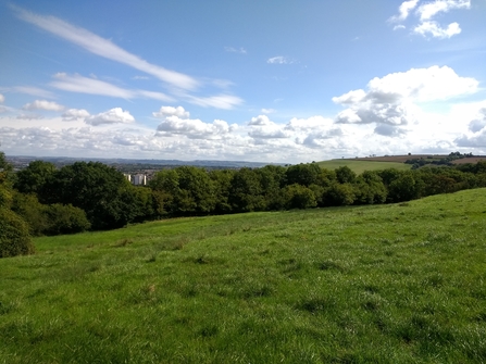
With stunning views over the city to the north and countryside to the south, being this high up gives a real escape from the hustle and bustle of the city. Explore the network of paths that wind through old woodland, criss-crossing streams lush with ferns and horsetails. Once deep in the woodland you can almost forget you’re in the city at all. The area is rich in wildlife and archaeological interest such as Roman roads, medieval trackways, hedgerows, stone walls, overgrown scrub, limestone grasslands and cropped fields.
Location: Our project site was south of Bishport Avenue in Hartcliffe. Walking routes already exist that advertise ‘the view from Dundry Hill extends for 35 miles; in the north to Bristol and the higher parts of Gloucestershire as far as the Malverns, and the west to the Bristol Channel and the Black Mountains of Wales’
Concerned about something at the site? You can report any issues directly to the landowner Bristol City Council here - Report a problem in a park or open space - bristol.gov.uk
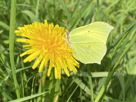
Brimstone Butterfly on Dandelion, Dundry Slopes, (c) Alex Dommett
Dundry Slopes, (c) Alex Dommett
Dundry Slopes, (c) Hannah Welsh
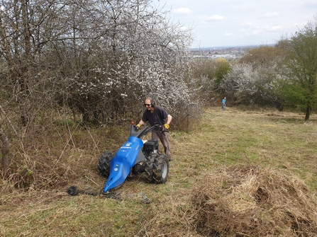
Wild Cats Meadow Cutting, Dundry Slopes, (c) Rosie Maple
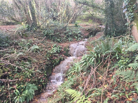
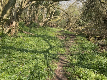
Stream, Dundry Slopes, (c) Rosie Maple
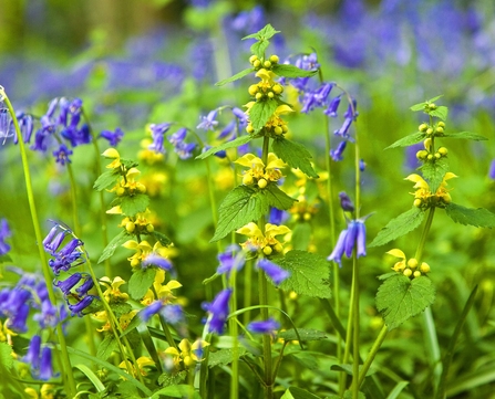
Yellow archangel and bluebells, (c) Paul Lane
Get involved: There are different individual local volunteers seeking to maintain, conserve and promote Dundry Slopes as a special site for people and for wildlife, as well as The Dundry and Hartcliffe Wildlife Conservation Group and the Maidenhead Hills - Dundry Slopes Group.
Contact the Dundry and Hartcliffe Wildlife Conservation Group at dundryhartcliffewcg@gmail.com.
On Facebook? Why not join The Maidenhead Dundry Slopes group for wildlife sightings, opportunities and updates. Or join BS13 Wildlife Group for wildlife spots and nature-friendly ideas across the area.
Wildlife monitoring is a great way to support local wildlife sites! Find out more about wildlife monitoring and how it helps protect nature on our blog here. Fancy looking for butterflies on the Slopes? There's already a butterfly route mapped for this special site Dundry Slopes Butterfly Monitoring.pdf (avonwildlifetrust.org.uk), you can also contact nature.parks@bristol.gov.uk for further support and explore options for wildlife monitoring across the city here.
Get the most from your visit with downloadable maps and resources below:

Dundry Slopes Map, (c) Rebecca Howard

Team Wilder, Illustration by Hannah Bunn
Want to do something for nature in your community? Find top tips, advice, and resources from people doing fantastic things for people and wildlife across the region, as part of Team Wilder here