
(c) John Seager
Green Shoots
An innovative restoration project with young people leading the way
Green Shoots is the neighbouring site to Grow Wilder, our urban nature reserve and food growing hub, and is home to an exciting collaborative restoration project, led by local young people.
In 2024, with support from the National Lottery Community Fund, Avon Wildlife Trust partnered with Action for Conservation on the Intergenerational Action for Climate and Nature project to take on this exciting initiative.

© Connor Meadows
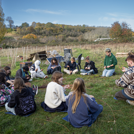
Youth Leadership Group
Our Youth Leadership Group (YLG) are 25 young people recruited to create and design a plan to bring the 5-acre site back to life in a way that helps restore it for the local community and for nature.
Over the coming years, the YLG will use a process of eco-cultural mapping – plotting out the changes to the site across the past, the present and the future – to imagine a new purpose for this unloved patch of brownfield land.
Latest Updates
Find all of the latest news from Green Shoots here - the most recent updates are at the top of this page.
Want to know the whole story?

Ongoing site works
There has been lots of change on the land at Green Shoots in recent weeks!
As part of our lease from the council, we are required to remove several old, damaged agricultural buildings. A large patch of bramble scrub was removed from site to allow access to the buildings, which have since been demolished.
During these works, several instances of asbestos were found, which has paused work to continue the removal of waste from the site. Work to progress this is now ongoing and we are grateful to our friends at Wring Group for working so hard to get the site accessible for us again!
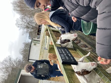
The YLG learned about building spaces at Windmill Hill City Farm...and met their goats too!

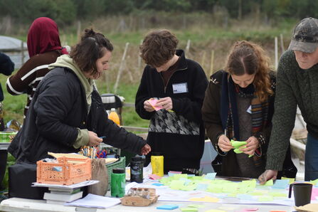
The YLG hosted a Community Hopes Day to get input from the local people around Green Shoots about what they’d like to see on the land. They then came together with Avon Wildlife Trust staff, Action for Conservation staff and members of Street Goat who house goats on Green Shoots to create a shared ‘future’ map. This map shows what everybody would like to see happen on Green Shoots over the next several years, and includes ideas such as a pond, new growing spaces and more habitats for wildlife.

November 2025 – Now: Present Mapping
To start the process of imaging the future of Green Shoots, our YLG visited different sites around Bristol to take inspiration for their future vision. They learnt about community and accessible spaces at Windmill Hill City Farm, nature restoration at Westbury Wildlife Park, and food growing with our team at Grow Wilder.
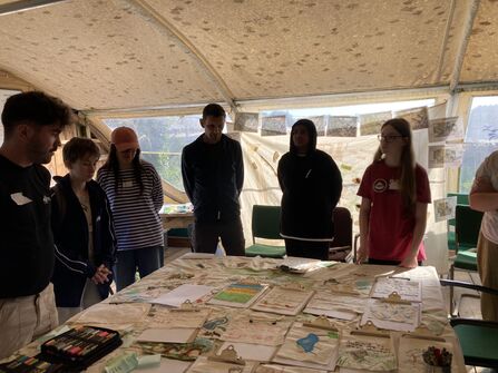
They also visited the Penpont Project, alongside the YLG from Heartwood Social Farm, in the second knowledge exchange of the project. The Penpont YLG showed everyone how they’ve created the changes they described in their future map – including the creation of a ‘land library’, tree nursery, and forest shelter.
© Connor Meadows
© Connor Meadows
© Connor Meadows
© Connor Meadows
In July, the YLG passed a big milestone in the project – naming their site. Together, they decided on Green Shoots – a name which suggests new life and hope for the future, capturing the site’s role as a place for people and nature to grow and thrive together.
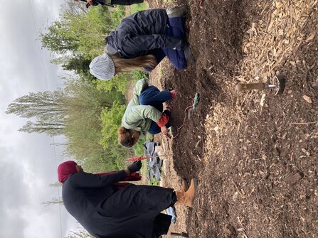
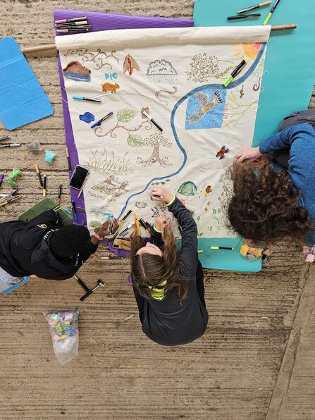
Finally, to pull together all the hard work over the past few months, in October, we created the ‘present’ map. The Youth Leadership Group brought together members of Avon Wildlife Trust staff, and community members to collect knowledge about Green Shoots and create a map showing what the site currently looks like, is used for and which wildlife is found on site.

© Connor Meadows
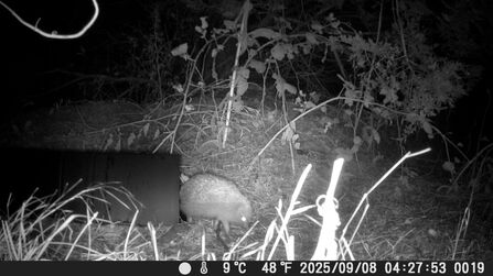
A big part of the present mapping process was monitoring what condition the site’s wildlife was in – from the soil up to the animals that use the space! The YLG carried out testing for nutrients in the soil and we brought in a new team of youth volunteers to help discover wildlife using the space – recording slow worms, hedgehogs and roe deer on site for the first time!

© Connor Meadows
The YLG's perspective
Etta, Sumaya and Jessica shared their experience of our first Community Open Day in a blog post:
Youth lead the way at Community Open Day
And Natalia, Jessica and Ezra described their knowledge exchange with other YLGs:
Exchanging ideas: Intergenerational Action for Climate & Nature project

© Connor Meadows
(C) Laura Kravac
(C) Laura Kravac
February 2025 – October 2025: Present Mapping
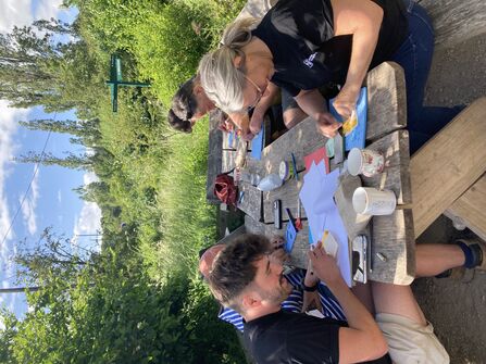
The Youth Leadership Group began the process of mapping the site’s present – exploring what the land currently means to people and wildlife. They created a map of place names, giving titles to distinctive landmarks and features of the site to help connect to the landscape!
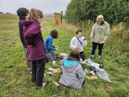
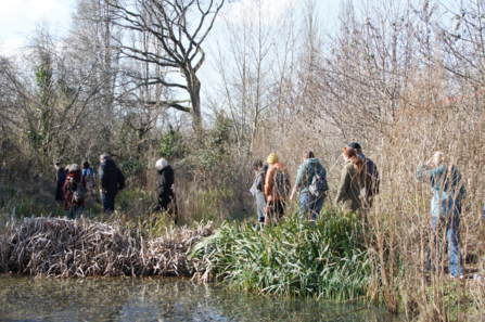
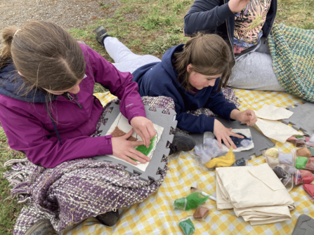
During this time, we also welcomed people to the site for our first events. At our Community Open Days, the YLG delivered tours, created community art, helped people to spot wildlife, and brought groups together to create experimental mini-habitats on the site, including a bee bank and a pond!
The YLG also welcomed the Youth Leadership Groups from the Penpont Project and Heartwood Social Farm - two other sites that are part of the funded project – for a knowledge exchange. Everyone shared their experiences of the mapping process so far and collaborated to create a new gathering space for groups to use when visiting the site.
© Connor Meadows
© Connor Meadows
(C) Stephanie Chadwick
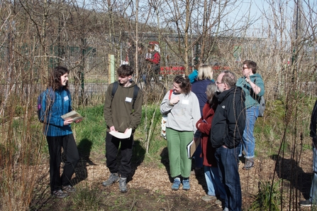
Read more about our YLG’s first meeting from our Youth Officer, Connor:
Youth Leadership Group to transform new nature site

© Connor Meadows
October 2024 - January 2025: Recap
After achieving funding from the National Lottery Community Fund, the Intergenerational Action for Climate and Nature project kicked off in October 2024 with the first meeting of our Youth Leadership Group (YLG).
With some new young people joining the group, the first few months were spent exploring the site, reconnecting with the stories uncovered in the past mapping process by trying out some medieval crafts, such as willow weaving, and getting to know each other. The group explored historical changes to how people experienced and related to the land, from land privatisation and who holds the rights to land and nature, to the role the site has played in the local community over time. Use as an allotment for food-growing through the Second World War – and the impact of the M32’s construction continued to shape this land into the recent past.
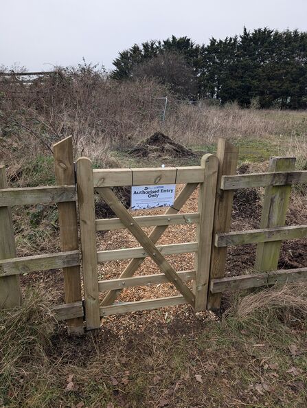
The Youth Leadership Group also made their first changes to the site, constructing a new accessible pathway and perimeter gate to ensure more people will be able to use the space when it is opened for events.

© Connor Meadows
The early stages: Past Mapping
As part of an initial pilot project, the first group of young people began the eco-cultural mapping process, looking at the brownfield site’s history.
Through talking to members of the community, visits to Bristol archives, discussions with ecologists and Avon Wildlife Trust staff, they were able to explore the site’s past all the way back to the Norman invasion of 1066. Across 4 maps, they showed the changes the land has experienced through the claiming of land for private estates, a wartime push for allotments and homegrown food supplies, up to the construction of the M32 motorway in the 1960s.
The young people put themselves in the shoes of people who used the land over this time – mostly farmers of common land and then allotment growers – and of the nature that will have called the space home – species like wild boar, wolves, and maybe even bears.
Contact
For more information about Green Shoots at Grow Wilder, please contact our Youth Officer, Connor, using the email below:
Acknowledgements
Thanks to National Lottery players and support from The National Lottery Community Fund, Green Shoots at Grow Wilder is part of the Intergenerational Action for Climate and Nature initiative, helping young people restore 650 acres of land across England and Wales.
